Showing posts with label hiking. Show all posts

Tuesday, September 06, 2011

Elfin Lakes

If you are ever on the west coast near Squamish, and plan to do some hiking, I highly recommend this hike to Elfin Lakes.  Situated in Garibaldi Park, Elfin Lakes is a fairly popular trail for both hikers and bikers, and on this long weekend it was quite busy, but not too busy so that we didn't have lots of quiet time with just the two of us hiking.

It looks like it's also a popular snowshoe hike in the winter as well.

Sunday the weather was incredible. It was a very warm day (mid 20s). I had read online that there would most likely be snow along the trail. There was. It covered several sections of the trail, but the trail was well marked.
A great part of the hike is along Paul Ridge.
 The views were unbelievable. Snow-capped mountains were all around. I felt like I was in another world, and so close to home!
 Tantalus Ridge.
 Mt. Garibaldi was a constant view along the trail. We never lost sight of this beautiful peak.
 One of the most beautiful trails I've hiked. The climb is quite reasonable as well. There's not a steep, steep grade like some other hikes I've done to reach views like this. Much of the elevation is climbed on the drive up, so it didn't take long to hike up into the snow.
 First view of the lakes! We would have to hike through more snow to descend to the lakes.
 Drinking lake or Swimming lake? I can't remember which one this is. I suspect it's the swimming lake since we spent more time at that one, and had our lunch next to it. We did refill our bottles from the drinking lake. As a rule, I never drink water from lakes or creeks (beaver-fever -- or Giardia -- and other nasties being the risk), but that little glacial lake seemed pristine and was marked as a drinking water lake, so I went for it (no beavers at that elevation I'm sure!). It was cold and refreshing.
 I took this shot while I was in the lake, so I guess it is the swimming lake.
 Here's my proof that I went into the lake, only up to my knees, and not just because that was the length of my pants. You have no idea how cold this water is! It's an ice bath. I felt okay as long as I didn't move, and I stayed as long as I could stand it. It felt amazing! There was a man on the other side of the lake who dipped in quickly up to his neck, let out a whoop, and rushed out. He did that a couple of times. It was quite entertaining.

When I stepped out of the lake onto the snow, I didn't even notice how cold the snow was. I have to say that the hike back to the parking lot was a lot easier after reviving my legs in the lake.


 One of the many valley views. The pictures of the valley do not do it justice. Sometimes the valley below looked as if viewing from a plane. We looked down at trees and meadows, sometimes small ponds appeared along the route. I kept watching for bears to appear in the valley because this area of Garibaldi Park is known to have the highest concentration of black bears. I think the trail was probably too busy for any bear to appear, and it was a fairly warm day, so it wouldn't surprise me if they were all hanging out in the shade somewhere, or knew much quieter areas.

 Mountain heather is abundant along the trail and in the meadows. There were lots of wild flowers, and because of the late summer we've had I still saw lupins and daisies.
 Back into the forest.
 False morel. There is a sign at the entrance of the park reminding people that mushroom foraging is prohibited. It must be picked over though. It wouldn't surprise me, and there's probably a reason for such a sign.
 Wildflowers! My favorite is this wild tiger lily. It's actually quite tiny. It's hard to tell from the photograph, but it's probably a bit smaller than an average daisy bloom.
 I was really excited to have seen these along the trail. I don't know how I missed them on the way up the trail, but I did see them on the way down.
Elfin Lakes is now one of my favorite places in B.C. Our second hike in Garibaldi Park and they both seem to be at the top of my favorites list.

Sunday, February 27, 2011

hiking the Lynn Valley Loop

 I've been wanting to go to the Lynn Valley for sometime because I know there are several trails that are very accessible. I read about the "Lynn Valley Loop" trail online (very useful website, btw) as an easy going trail that could be completed less than a couple of hours, and was fine to hike year round.
 db and I only have Sundays together and I also have gone back to doing my long run on Sundays, so we don't have the whole day to do a 5 hour hike, so this seemed like a good option. As we went up higher there was some snow, but you can see that the trail is well travelled. Actually, the fact that it is well traveled made it a bit trickier because the snow was packed into a slippery sheet that made the first part of the descent a bit tricky, but overall it was fine.


 Lynn Creek was crystal clear and it runs alongside part of the trail near the end. It was nice to hear just the sound of the water and our footsteps.
Left over from logging days? I liked the tree growing up through the back end.
There is much evidence of the the logging that was done in this area. There are many large stumps with the platform notches in the side of them where loggers placed 2x4s to stand on while they worked each side of the saw to cut the tree. It's a common site along trails all over the lower mainland. I would love to hike in an old growth forest that had never been logged.

I just recently signed up for my first trail run. It's only 5 k, but I thought I should start small since I don't have much time to train on trail and can't do long distances on trail without a partner (gotta find a trail running partner!). The 5 k is actually called My First Trail Race and is in this same area where we hiked, so I'm going for it. I hope my trail shoes arrive soon!

Monday, July 05, 2010

trip to Bowen Island & Mt Gardner

We got lucky. We had good weather, and decided that we would drive to the ferry and go to Bowen Island to do our planned hike up Mt Gardner.  You can walk on the ferry since the hike is walking distance from the ferry, and there are a couple of smaller trails to take to get you to the beginning of the Mt. Gardner hike.

Lots of slugs along the way. Each one seemed bigger than the one before. We started to think that maybe they got larger the higher we hiked!
The first view on the way up that looks back down to where we arrived.
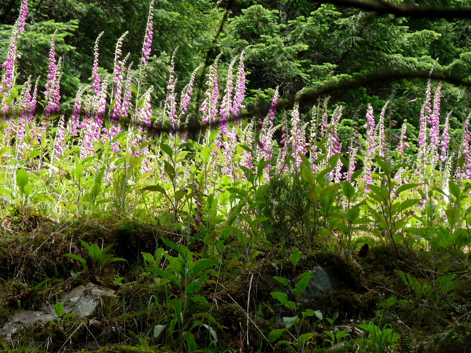
Foxgloves were abundant. Why do I have such a hard time growing them?
This was an unusual and cool looking part of the trail. This was along the "handloggers trail." There are several options to approach Mt. Gardner. We took several linking trails to wind our way up rather than taking a more direct (and perhaps less interesting) route.
Looks like some Angel wings...I think. Edible, but we didn't collect any as there were too few to really bother.


Second view: I think this is looking at Keets island.
New growth amongst the old growth.
We went to the North Summit where the views are. There are also radio towers and 2 helicopter landing pads. I think this is why the N. Summit has the views that the S. Summit doesn't.

View from the top. This looks down towards the Sunshine Coast. The clouds were covering the distant mountains, and at times some low cloud passed closely by. It was beautiful. We sat on the wooden slatted chopper landing pad and had lunch.

Playing with the sepia setting on the camera on the way down the mountain. 

After our long 6 hour plus hike, we reached our destination...


The Tuscany

The food was amazing as usual. It was a perfect way to end our day.
 Warm citrus olives with a bruschetta salad & grilled portabellos.

Ah, the pizza with grilled veg. They have a wood burning oven to cook their pizza. There's nothing like a pizza cooked in a wood burning oven.


Back to the mainland. What a beautiful day!

Wednesday, August 12, 2009

Hike No. 6


This weeks hike took us to the famous Stawamus Chief in Squamish. It's a popular hike and was indeed a busy trail, but well worth it. It's a fairly steep climb. We discovered that while I prefer climbing over descending, db is the opposite. He prefers the descent over climbing. It shows in our pace because I'm faster going up while he's much faster going down while I peck my way down the rocks and tree roots.

That is the trail. It is all rock and tree roots. There is a creek near the bottom and another trail that leads to Shannon Falls, but that's another hike.

How do so many massive trees grow in amongst this rock? I guess it's possible because there they are, all those trees growing mostly in the gullies.
Near the top of the second peak (we skipped the first peak just to save on time and we were following a hike outlined in my book) you have to leave the gully and climb up onto the rock. I was surprised because I wasn't expecting chains to guide us, which were very necessary in several parts of the climb.
There was one junction where we had to wait while several people descended because one particular spot is a bit of a stretch while you hang onto the chain. When db and I first arrived at this spot we were alone, and he went first and hopped across to the next landing. I started to follow, but then baulked at the small jump onto some tree roots. I just didn't feel steady enough even with the chain. That's when the first group of people coming down appeared. I stayed on one side while db was on the other and we watched person after person climb down the rock and then make the jump some with great ease and others with some hesitation. Meanwhile another group from Australia arrived behind us. I felt the pressure to take the first step after everyone of the descenders had passed. One of the Australians motioned to the chain and said "after you." I grabbed on and jumped and it was no problem really. Perhaps that rest and watching everyone cross that junction made it easier for me. I didn't even think about it.

After that you just hang on and keep climbing until you reach the top.

It was very cloudy. It had rained earlier in the day, but not enough to leave any water behind on the trail or the rock.
The clouds would break and we could see Squamish below and the other two peaks on either side of us. I loved the rock surface so rough and weathered looking. There are bits of dried moss and patches of colour where the rock changes. It's also quite hilly in parts where it looks like you might climb up and be on the edge of a cliff. There are a few trees that look stunted and as weather worn as the rock itself. I found it quite beautiful up there.

We found a spot to sit and watch the clouds drift before us. We did get a few misty droplets of rain as the clouds came and went. It looks like some got on the lens.

The water was such a beautiful colour.

On a clearer day I'm sure we could have seen some of the snowy peaks to the north, but I really enjoyed watching the clouds sweep over the rock. In the above photo that's the first peak just below us and I believe it's the mouth of the Squamish River
On the way down we decided to save the third peak for another time and take the less travelled North Gully back to the campground/parking lot. There was a great view just between the two peaks and the sky cleared enough to see the town below.
The North Gully was a really nice hike. It wasn't well marked at the trail head, but was well marked the whole way down. It was much quieter. We only saw a couple of people on the way down until we reached a rockface where a couple of climbers were scaling up the side of the rock. Very brave. Eventually the North Gully hooked up to the main trail near the bottom and we were back on the busy route, but by then we were so close to the bottom of the climb I didn't mind the traffic.
It's definitely on the list for when my brother and C. visit again. They'll love it.

Back at home I was happy to see that my President clematis finally bloomed. It's probably not happy that I had to move it this year, but at least I got one bloom. Next year hopefully more will show.